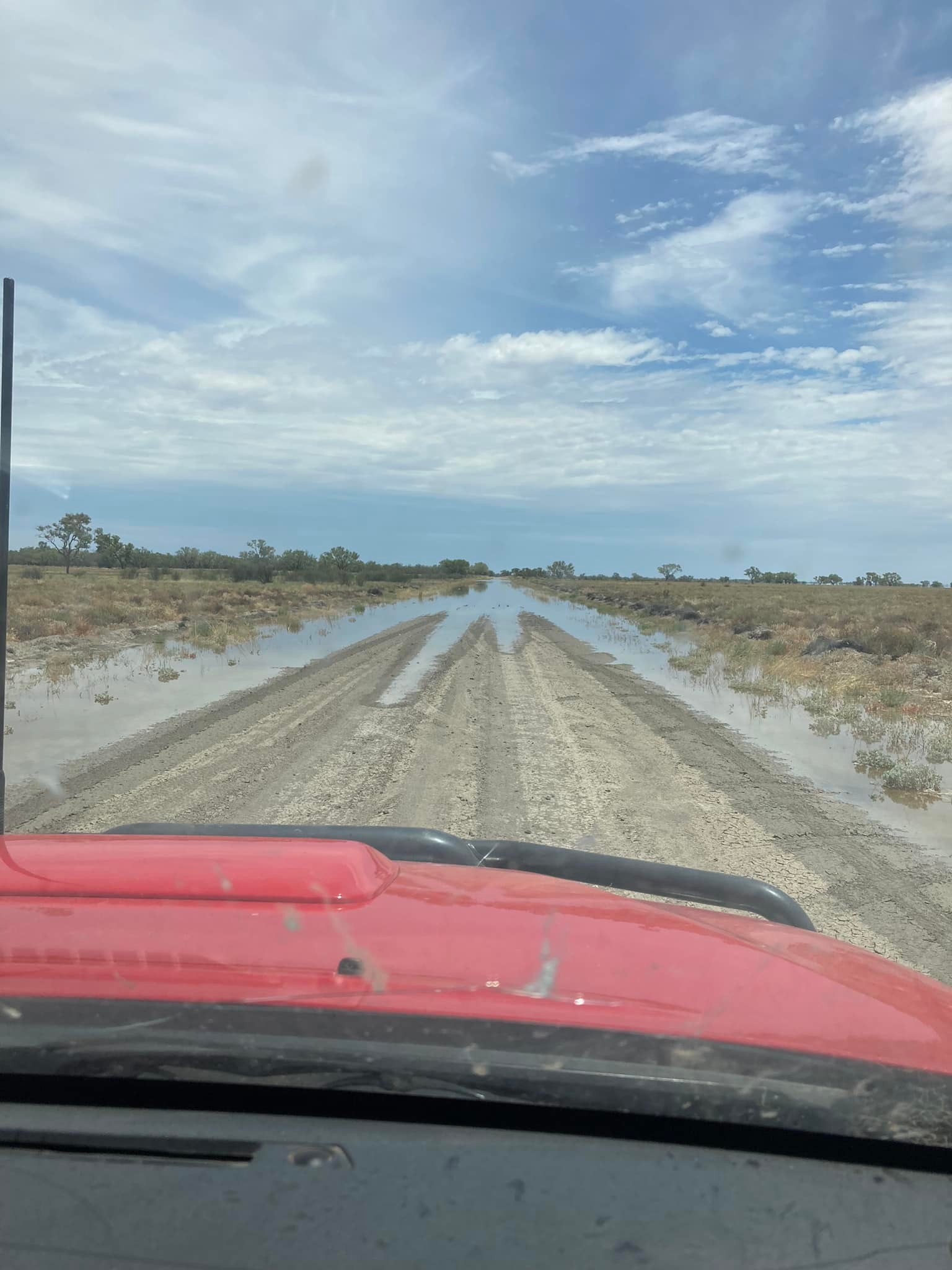
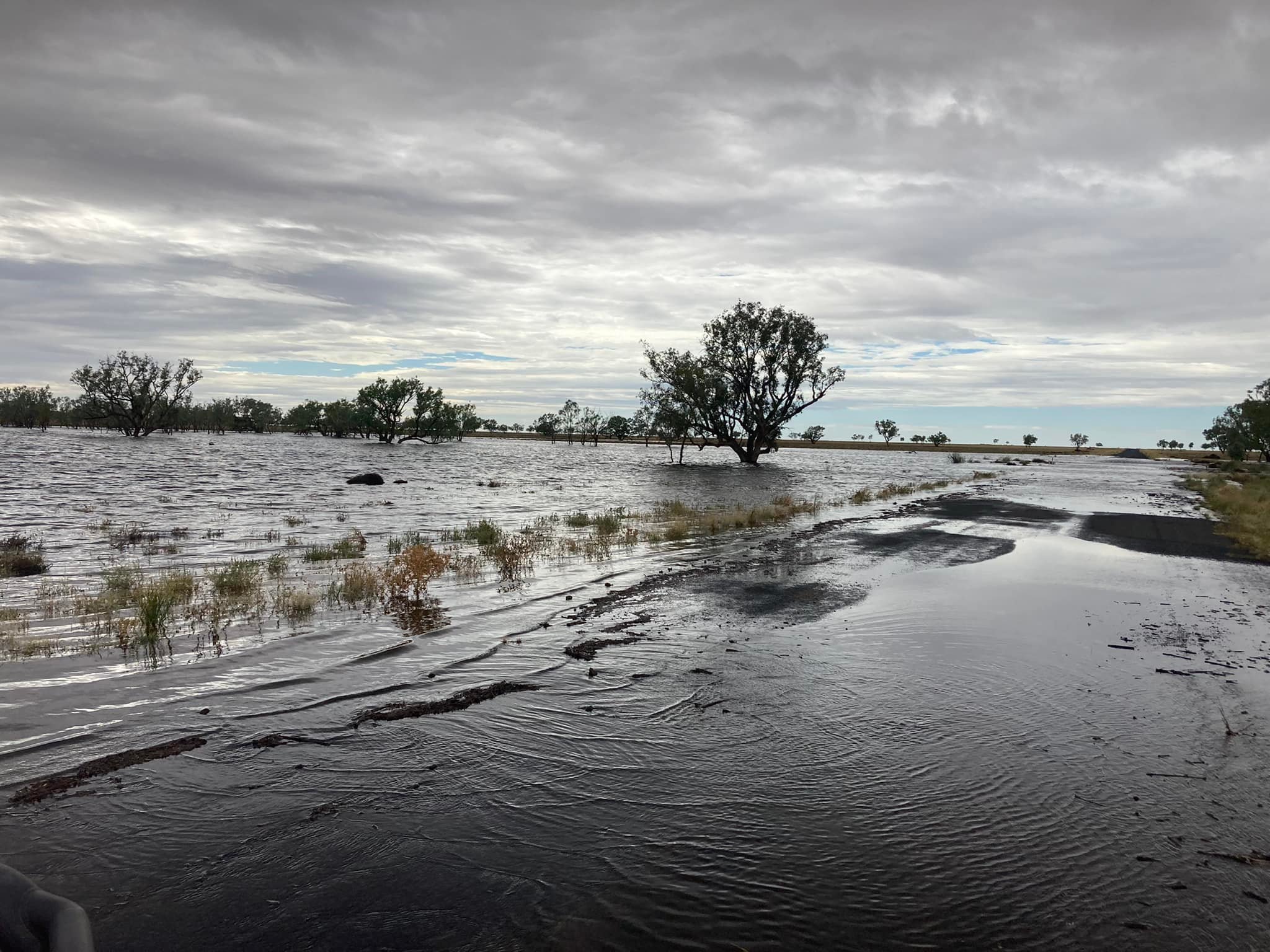
Floodwaters in western New South Wales have continued to inundate roads and isolate residents as officials warn the peak is still yet to come.
The Darling River has overflowed throughout the regional towns of Wilcannia, Tilpa, Bourke and Menindee Lakes, with the Bureau of Meteorology (BoM) warning streams will peak at Louth tomorrow.
"The main flood peak along the Darling River is now downstream of Bourke. This peak is expected to reach Louth around Friday to Saturday, with major flooding," the BoM said.
LIVE UPDATES: Keeping the WA border closed 'sensible', says Wayne Swan
"Major flooding is occurring along the Darling River at Tilpa where river levels exceeded the major flood level (11.50 metres) early Tuesday morning.
"River levels at Tilpa are expected to peak at the end of January.
"River levels at Menindee are likely to remain near the minor flood level until late February, as releases from the Menindee Lakes system are made to make room for the upstream flood waters."
Residents in affected areas have been told to stay out of rising water, seek refuge at the highest available place and move vehicles away from the deluge.
READ MORE: Both devastation and support for McGowan's WA border shut out

READ MORE: Victoria records 18,167 new COVID-19 infections and 20 deaths
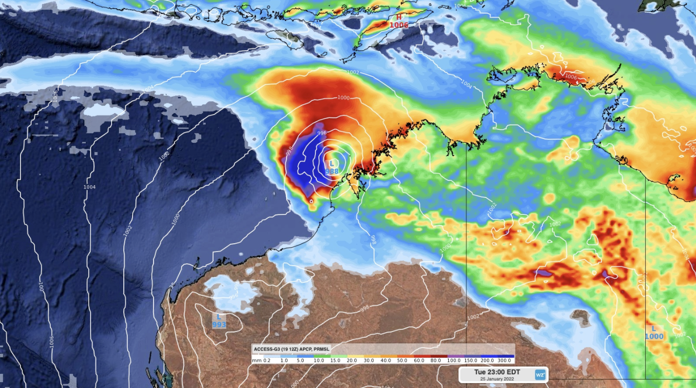
Meanwhile, meteorologists have said there are signs that increasing rain and thunderstorms over northern Australia during the next week could develop into tropical cyclone.
A monsoon trough is expected to move over northern Australia over the next few days - bringing heavy rain and storm activity - could increase in some northern parts of Queensland, the NT and WA.
"This increase in convective activity could cause a low-pressure system to develop within the trough, most likely over the Timor Sea later this week," Weatherzone warned.
"Some models suggest that this low could move south towards the Kimberley coast on the weekend and early next week, where it has the potential to develop into a tropical cyclone."
In South Australia, a severe weather warning for heavy rainfall has been issued for people in parts of the West Coast, Lower Eyre Peninsula, Eastern Eyre Peninsula, North West Pastoral and North East Pastoral districts.
"An upper level low pressure system and associated surface trough is developing over the west of the state and is expected to move slowly eastwards over the next few days," the BoM said.
https://twitter.com/BOM_SA/status/1484035901709852679?ref_src=twsrc%5Etfw"Areas of heavy rain and thunderstorms are expected from Thursday onwards over parts of the Flood Watch area, with the risk gradually moving eastwards.
"Four day rainfall totals to midnight Sunday of 60-100 mm are likely, with isolated higher falls in excess of 120 mm possible with thunderstorms."
Elsewhere across the country, it'll be hot and sunny in Victoria, will Melbourne set to swelter through above 30C conditions today, mild and cloudy in the ACT, with tops of 24C in Canberra, and 27C and cloudy in Brisbane.