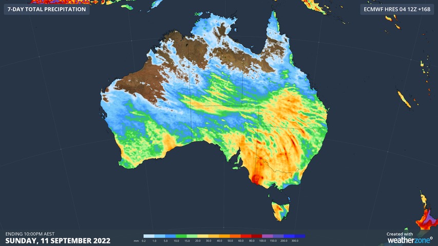
The first full week of spring will bring rain to every state and territory across Australia, with possible floods to follow.
Weatherzone has reported that a low pressure system and a cold front both meeting tropical moisture will build up a north-west cloud-band to pass over Australia this week.
Western Australia is set to cop the brunt of it early on, with the front passing over the state by the end of today.
READ MORE: Government settles lawsuit with former Coalition staffer for $650,000

Then it will be the Northern Territory and South Australia in the firing line, with rain set to fall today and tomorrow.
Thursday and Friday will see the south east and east of the country drenched once more.
That won't be the end of it though; Weatherzone said "follow-up" rain would fall over central and south-eastern Australia from another cloud band and cold front.
There are particular concerns for flooding in the Murray Darling Basin, the entirety of which is set to cop a soaking.
READ MORE: Tributes to Australian medic killed in Ukraine
The basin recorded its wettest August since 1985 last month, and its water storage levels are at 97 per cent.
Thunderstorms are also forecast, mostly over central Australia, northern New South Wales, and Queensland.
People are urged to stay up to date on flood and weather warnings at the Bureau of Meteorology website.
