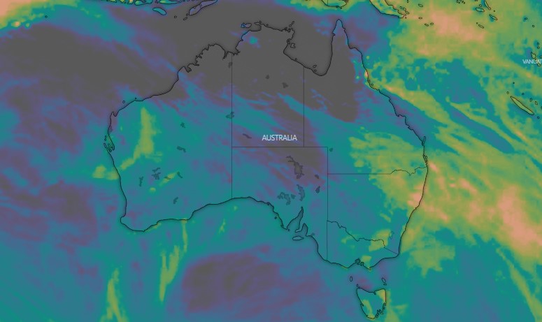
As the prospect of a third consecutive La Nina firms further, all indicators are that it's going to be a wet and dreary spring for eastern Australia.
Although we're out of winter - by two days - the cool weather and overcast skies aren't going to be left behind.
Here's what you need to know.
READ MORE: Uyghurs who spoke out against China see 'justice' in UN report

What's the forecast?
The Bureau of Meteorology has forecast above-average rainfall through the season, with all associated risks.
"Where soils and catchments are wet, and streamflows are high, further rainfall this spring will increase the risk of flooding for eastern Australia," Bureau of Meteorology senior climatologist Dr Lynette Bettio said.
"In northern Australia, the first rains of the wet season are likely be earlier than normal for much of Queensland and the Northern Territory."
LIVE UPDATES: PM rules out new tax strike on mining giants
October is the official beginning of the wet season across northern Australia.
But, Bettio said, parts of Western Australia and western Tasmania are likely to experience below average rainfall this spring.
Almost all of Australia is likely to experience warmer than average nights, while cooler days are likely for large parts of the mainland except the tropical north.
Why are we getting more rain?
Weatherzone has analysed several key climatic factors that will bring the moisture to Australia's east.
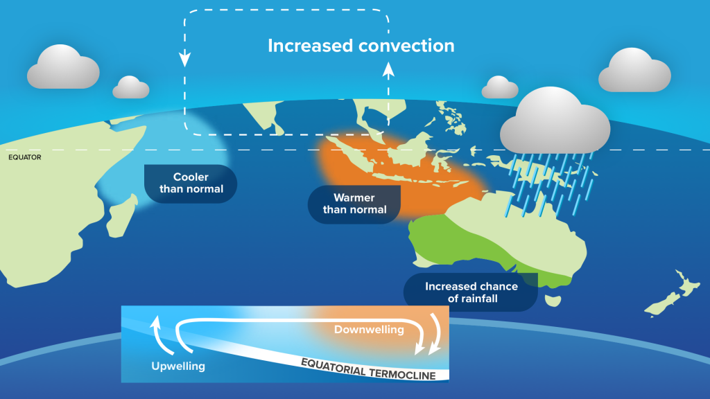
A negative Indian Ocean Dipole was declared in August, meaning the sea surface temperatures in the tropical Indian Ocean will cause more wet air to flow towards Australia.
This happens, on average, about once every five years.
READ MORE: Why watermelons are so expensive right now

This year's negative IOD is likely to continue through to early summer.
The Southern Annular Mode (SAM) - an index that measures the north-south displacement of the westerly winds that flow between Australia and Antarctica - is also favouring east coast rain.
A positive SAM, like the current one, usually causes reduced wind and rainfall in southern Australia during spring.
But in eastern Australia, it leads to typically above-average rain in spring and summer.

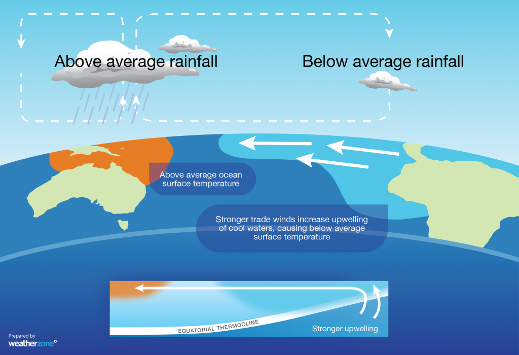
And then, of course, there's La Nina.
The Bureau of Meteorology has predicted a 70 per cent chance of a third consecutive La Nina forming this year.
This would lead to - you guessed it - heavier rain for the east in spring, before it dwindled into summer.
What does this mean for bushfire season?
The wet weather is certainly set to reduce the risk of large bushfires in eastern NSW and Victoria.
This includes many areas still recovering from the devastating Black Summer blazes.
However, a higher risk is forecast for other parts of the country, including in Central Australia and northern Western Australia.
