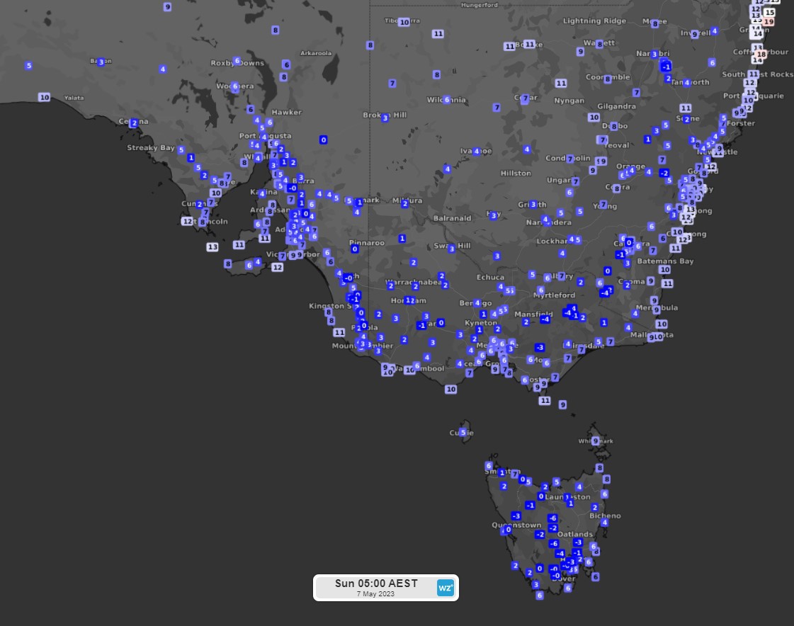
Aussies have shivered through their first taste of winter for this year as the mercury plunged to single digits in south-eastern states overnight.
A cold front crossed southern Australia across the New South Wales coast bringing a wintery blast to millions.
Temperatures dropped to single digits from South Australia to New South Wales but coastal areas remained in the mid-teens due to the maritime influence.
"Many elevated areas dropped below 0 degrees, with sleet and snow falling over the eastern ranges," Weatherzone said.
All three southern states feel below the May average.
NSW was 2 to 5 degrees below the average, Victoria by 3 to 7 degrees, South Australia by 3 to 8 degrees and Tasmania by 2 to 10 degrees.
A couple of towns were "exceptionally chilly", Weatherzone said, including Cape Sorell in Tasmania at just 3.5 degrees which is its coldest May night in 54 years.
But it was even colder in Ouse in Tasmania where the mercury plummeted to -6.1 degrees which is the town's coldest May night in 15 years.
The cold temperatures breaking records continued in May with Strahan Aerodrome in Tasmania falling to -0.6 degrees in the coldest May night in 22 years.
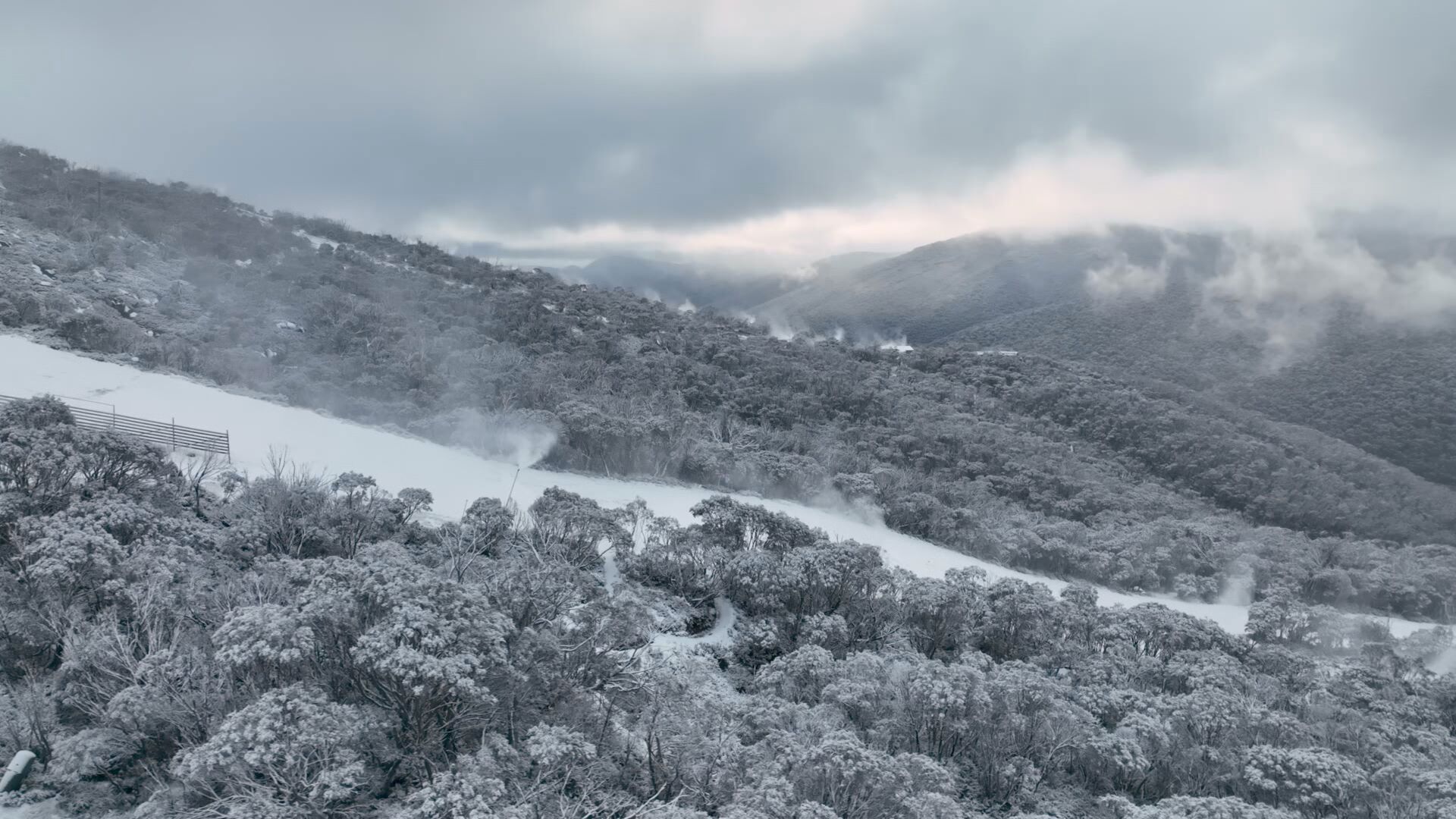
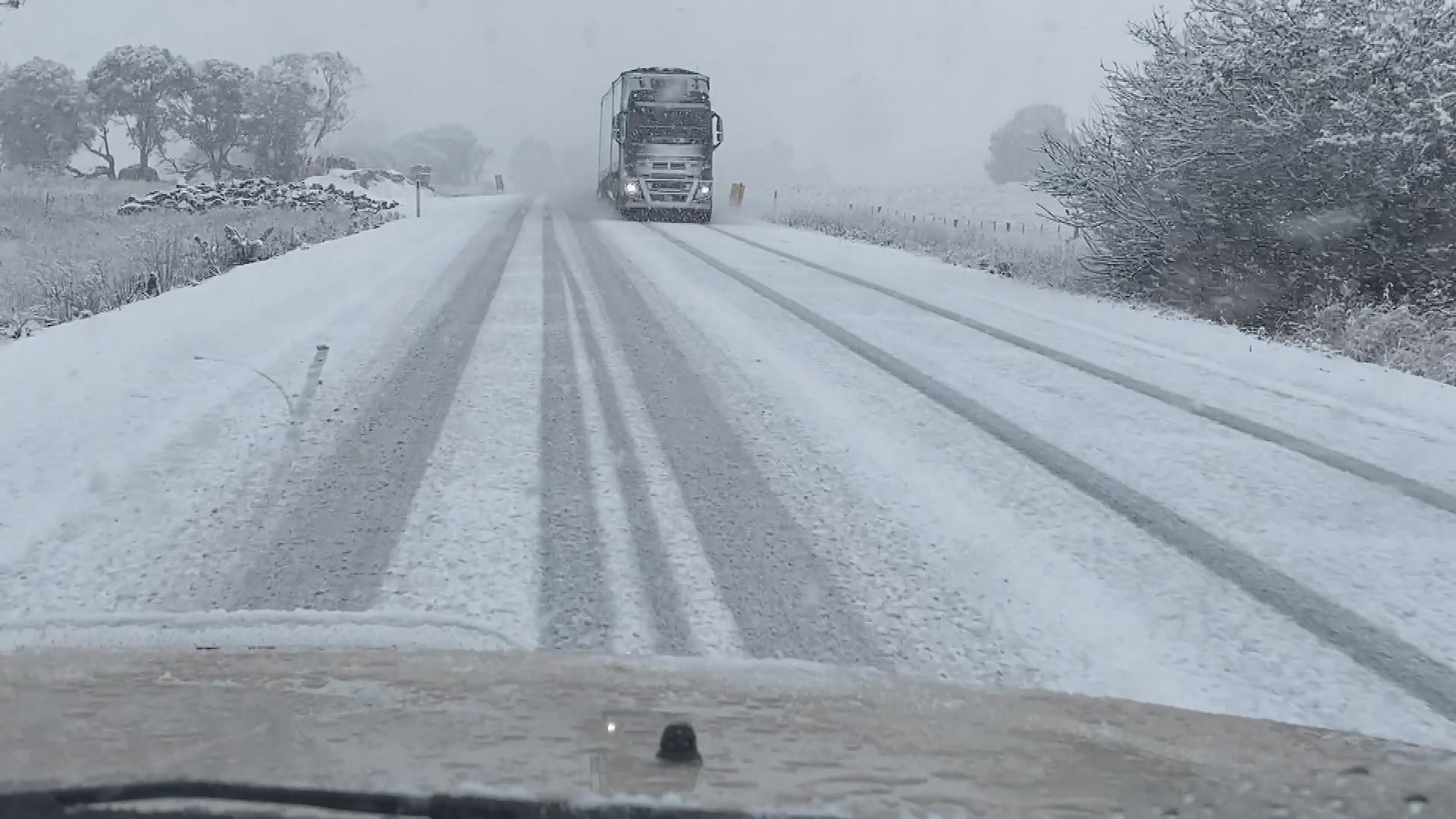
It might feel too early in the year but snow fell across the three states, with Thredbo becoming a skier's delight during the cold snap.
Thredbo and Perisher received at least 10cm of fresh powder overnight.
But other parts of regional NSW including the Southern Highlands copped a layer of snow when Bowral and Robertson frosted over.
READ MORE: Seven people dead after driver hits crowd at Texas bus stop
It isn't just snow for NSW with a severe weather warning in place for strong wind gusts today.
The Bureau of Meteorology issued the warning on Monday due to a low pressure system near the South Coast moving north east today.
"Locally damaging winds averaging 60 to 70 km/h with peak gusts of around 90 km/h are possible over the Illawarra and southern Sydney Metropolitan coastline overnight, with gusts of around 100 km/h possible for Jervis Bay. Winds are expected to ease late this morning," the bureau said.
A wind gust of 93 km/h and sustained winds of 65 km/h were recorded at Kiama early this morning.
A damaging surf warning is also in place for Kurnell, Wollongong, Bulli, Port Kembla, Albion Park, Kiama, Jervis Bay and Huskisson.
Some parts could see waves in excess of six metres in height.
Victoria has also seen its coldest start to May in three years with up to 10cm of snow falling in some parts.
READ MORE: Victorian government to axe millions in power bill support for vulnerable
Monday is looking to remain cool across the southeast of Australia as the cold mass lingers with temperatures returning to more average conditions from Tuesday, Weatherzone added.
Sydney will reach a top of 18 degrees today and a low of 8 degrees.
Melbourne will reach 15 degrees with a low of 7 degrees and Adelaide a top of 16 degrees and a low of 9 degrees.
Meanwhile Queensland will get a taste of winter today, with temperatures plunging to 10 degrees in Brisbane
For other capitals, Perth will see a top of 24 degrees today and a low of 14 degrees.
Darwin will see a maximum of 35 degrees and a low of 24 degrees.
In Tasmania, temperatures will remain icy with a top of 15 degrees and a low of 3 degrees.
Sign up here to receive our daily newsletters and breaking news alerts, sent straight to your inbox.