Australia's warm start to winter has seen records tumble, but you wouldn't know it depending on where you are, with a stormy "thundersnow" event also hammering our alpine regions this week.
Weatherzone reported that large parts of Australia experienced warmer than usual temperatures for the first fortnight of June, particularly in the central, eastern, and south-eastern parts of the country.
Melbourne has had its sixth warmest start to winter in 169 years of records, with an average minimum temperature of 10 degrees in the past fortnight.
READ MORE: Ben Roberts-Smith breaks silence as he returns to Australia

Longreach in Queensland averaged a maximum of 28.6 degrees in that same time - five degrees above average and the town's warmest winter start since 1897.
Adelaide's mean temperature was 16.1 degrees - its second warmest beginning to winter since 1887.
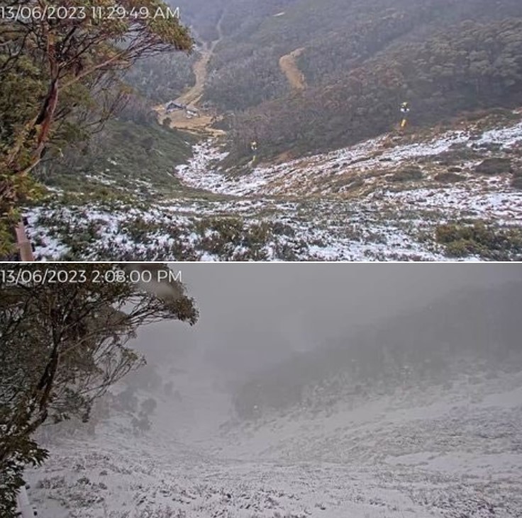
But it's still winter and that has meant snow in Australia's south-eastern mountains, although this time with an unusual companion.
READ MORE: Nottingham killer suspect caught on camera moments before stabbing
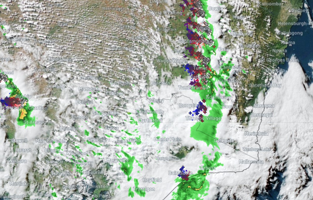
Weatherstone reported a flurry of "thundersnow" earlier this week in the Australian Alps.
A map shows multiple lightning strikes around Thredbo Village near Mount Kosciuszko.
As Weatherzone explains, lightning usually comes with warm air, but it can also strike when it's cold enough to snow.
"With most thunderstorms, you have relatively warm air sitting below cooler air, which creates an unstable atmosphere and causes the warmer air to rise," meteorologist Ben Domensino said.
READ MORE: Teachers raised issue about Hunter bus driver
"In snowy areas, there is generally only a small temperature contrast between the surface and upper levels, so there's usually not enough instability to create the uplift needed for thunderstorm development.
"But when you've got a very cold airmass, there can be enough of a temperature contrast between surface and upper level temperatures to make storms."
Another snowy weather system is expected next week.
Sign up here to receive our daily newsletters and breaking news alerts, sent straight to your inbox.