Residents across south-west Western Australia are bracing for a rare severe cold front to impact the region this morning.
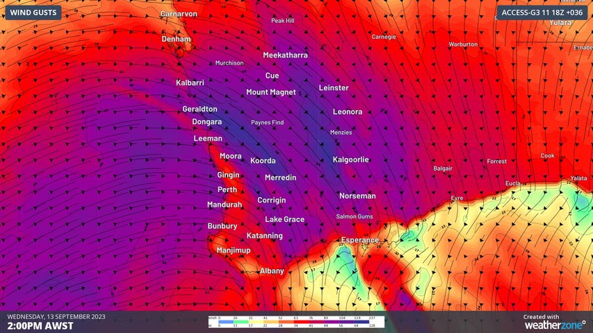
Forecasters are warning of gusts expected to reach up to 125km/h and severe storms with heavy rain over coming hours, reports Weatherzone.
The extremely strong cold front happens only twice a year but today's will impact an area the size of New South Wales.
READ MORE: Girl approached by stranger while walking home from school in Perth

The Bureau of Meteorology has issued a severe weather warning for destructive winds.
All areas south of a line from Carnarvon to the Northern Territory-South Australia-Western Australia border junction are a risk to see damaging wind gusts exceeding 90km/h, with some areas possibly seeing gusts above 110km/h.
Dangerous surf conditions are also expected. Wave heights are likely to reach 6m to 7m along the WA south coast.
The gusty winds ahead of the cold front will coincide with heat, increasing fire danger across the region, but particularly for the central inland.
The North Goldfields and South Interior fire districts are forecast to see extreme fire danger today, with models showing some localised areas possibly reaching catastrophic rating.
By late morning, thunderstorms are set to cross the west coast, including Perth. Heavy showers and storms are a high chance to bring powerful wind gusts exceeding 90km/h and potentially exceeding 125km/h.
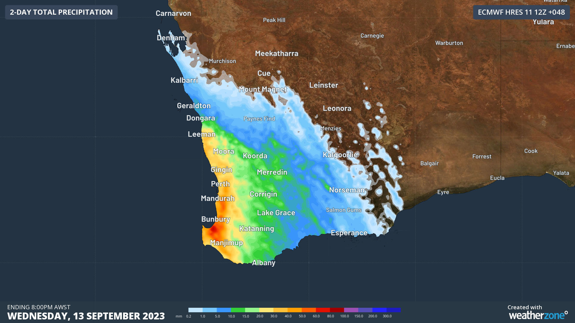
Heavy rain is also possible, with 20mm-50mm expected in less than three hours in some areas, possibly producing flash-flooding.
Bureau of Meteorology meteorologist Jess Lingard told 9News the weather system will probably be one of the most severe cold fronts of the winter for WA.
READ MORE: Apple announces iPhone 15 with new charging port and advanced camera

"This system is definitely going to give our spring time rainfall a significant boost which really bodes us well in the outlooks for spring, where we do expect both a drier and warmer spring season."
The cold front will also bring a major drop in temperatures after many parts of WA sweltered through the the hottest September night on record.
On Monday, Kalgoorlie sweated through its hottest September minimum in 82 years of records, staying above 22 degrees all night.
