Residents in Perth and Western Australia's south-west are being urged to keep a close eye on the horizon as ex-tropical cyclone Narelle prepares to redevelop on the open ocean.
After drenching the Northern Territory and the Kimberley, the system is forecast to re-intensify into a powerful cyclone and could potentially track as far south as the state capital by the weekend.
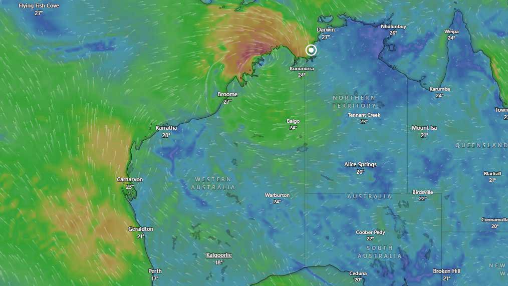
On Monday morning, Narelle was positioned as a tropical low over the Joseph Bonaparte Gulf, about 25 kilometres north-north-west of Wadeye.
READ MORE: Push for four-day week to manage fuel crisis in Australia
The system has already left a trail of destruction across the Northern Territory, where it made landfall as a category 3 cyclone on Saturday night.
According to Weatherzone, the deluge has been relentless. A rain gauge at Adelaide River Town recorded 202 millimetres in the 24 hours to 9am on Monday, triggering major flooding.
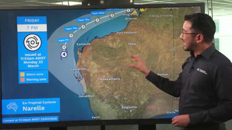
"Ex-Tropical Cyclone Narelle is expected to redevelop off the north coast of Western Australia later this week, before possibly turning south and heading towards Perth this weekend," Weatherzone reported.
The system was moving west across the northern Kimberley, bringing damaging gale-force winds and further flooding risks. However, the real concern begins on Wednesday.
Bureau of Meteorology meteorologist Jonathan How said that once the system moved off the Kimberley coast and over open water, it was expected to "re-intensify back into a tropical cyclone".
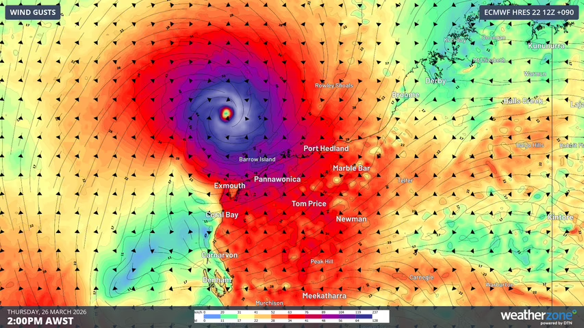
On Wednesday, Narelle is expected to reach category 2 or 3 strength, and by Thursday it could become a category 4 severe tropical cyclone as it tracks north of the Pilbara.
By late week, Weatherzone said there was a chance it could even reach category 5, the highest tier on the scale.
Will it hit Perth?
While the system is currently staying offshore from the Pilbara, computer models show a significant "curve" in the track starting on Friday.
"By Saturday morning, [it] is expected to lie somewhere between Carnarvon also down towards Geraldton," How said. "Beyond this, there is still a range of scenarios possible."
One of those scenarios is a direct impact on the south-west.
If Narelle tracks southwards, it is expected to accelerate and may transition into an extra-tropical cyclone.
While technically different in their energy sources, both systems are equally dangerous, capable of bringing powerful winds, heavy rain, and large waves to the Perth metropolitan area by Sunday.
A cyclone reaching Perth is an unusual occurrence, but it is not without precedent. Bureau records show that 14 systems classified as tropical cyclones have brought gale-force winds or property damage to Perth between 1910 and 2024.
The most recent comparison for many locals is Tropical Cyclone Seroja, which devastated Kalbarri in 2021. Jonathan How noted that while these events don't happen every season, the threat to Perth is real.
"Another possibility is that the system remains offshore for longer and actually crosses the coast further down towards the southwest, potentially impacting places like Perth and the far southwest of Western Australia," How said.
NEVER MISS A STORY: Get your breaking news and exclusive stories first by following us across all platforms.
- Download the 9NEWS App here via Apple and Google Play
- Make 9News your preferred source on Google by ticking this box here
- Sign up to our breaking newsletter here