The blast of wintry weather over southeastern Australia will continue into the weekend, with damaging winds forecast for some states.
The Bureau of Meteorology forecasts strong gusts to sweep through South Australia, New South Wales, Victoria, the south coast of Western Australia and the ACT.
South Australia will initially feel the windy blast along the Mount Lofty Ranges and parts of the coast from early today as a cold front sweeps across the state.
READ MORE: Obama, Pelosi and Democrats make fresh push for Biden to reconsider 2024 race
The bureau warns average wind speeds of about 60km/h will strengthen to damaging gusts of up to 100 km/h later today and continue into early tomorrow.
The winds will be accompanied by rain, hail and snow in some parts.
Adelaide, Port Lincoln, Ceduna, Kingscote, Victor Harbor and Meningie are likely to feel the brunt of the severe weather.
Damaging winds peaking at 100km/h will also lash Victoria's northeast alpine region and the Grampians from later today, with blizzards also likely.
They'll then move up the coast into the Snowy Mountains region of New South Wales and the ACT from late today.
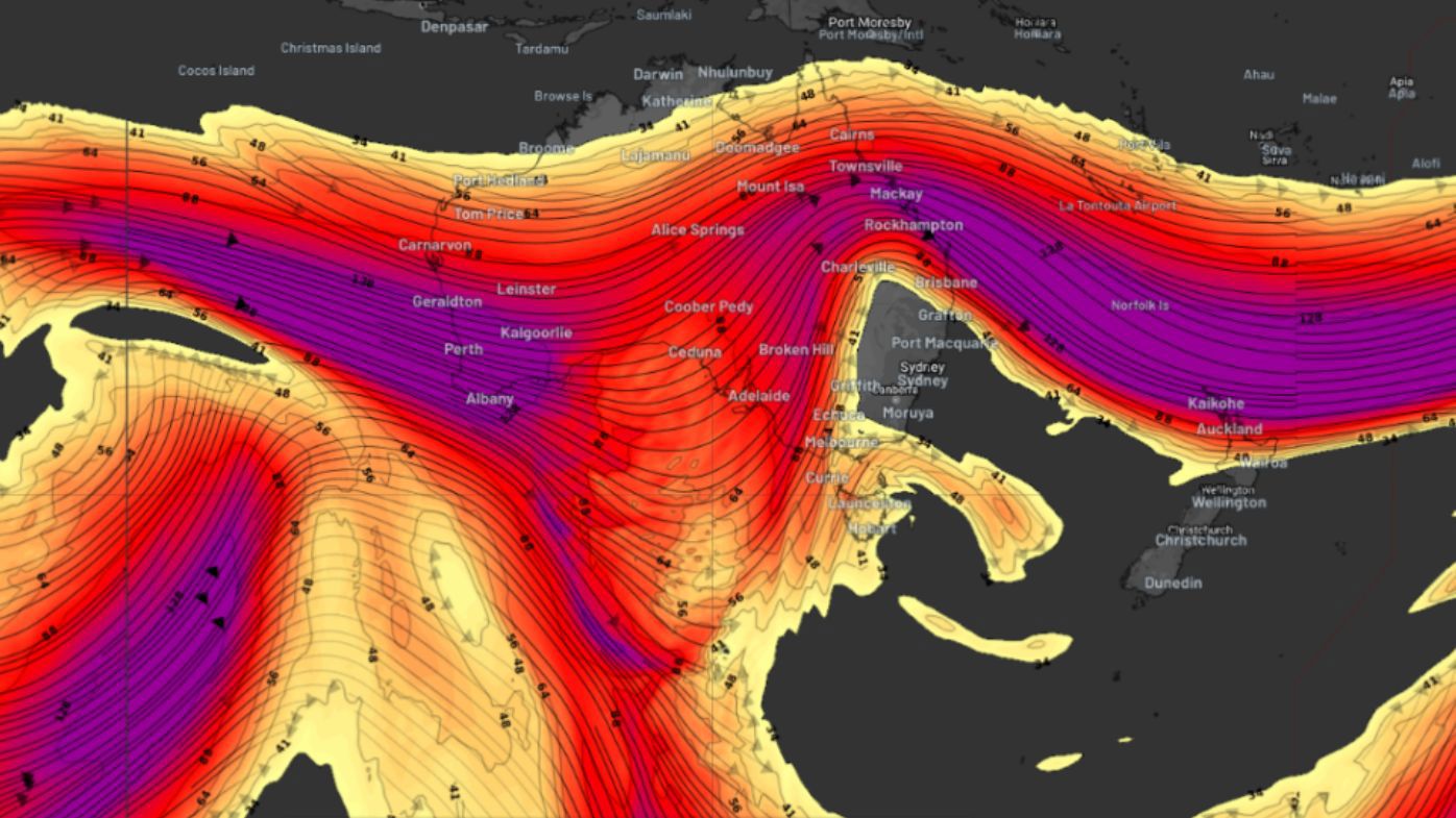
Forecasters say the cause of this severe weather is a change in the jetstream hanging over Australia.
Jetstreams are bands of fast-moving air that sit about 10km above the surface. They typically flow from west to east and lie between regions of contrasting temperatures.
But since yesterday the one over Australia started bending and flowing in more of a north-to-south orientation.
This is called a meridional pattern and typically brings unusually hot or cold weather.